ADVERTISEMENT
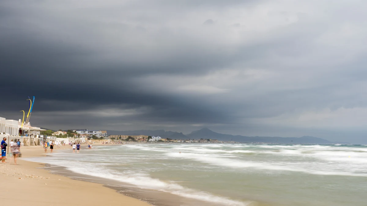
Heavy downpours have already caused flooding and traffic disruption in Valencia. On the Costa Blanca, the impact has so far been minor, but the critical phase is not yet over: an orange alert is in place for parts of the province of Alicante on Thursday. Schools will remain closed or open, depending on the local authority..
As at: Thursday, 17 September 2026, 8.30 am
On Thursday, the Costa Blanca is set to face what are expected to be the most critical hours of the current storm. Whilst violent thunderstorms on Wednesday evening flooded roads in Valencia, disrupted public transport and temporarily paralysed the airport, no comparable damage has yet been confirmed between Dénia and Pilar de la Horadada in the early hours of the morning.
This can change quickly at a local level. Weather warnings for heavy rain and thunderstorms remain in place for coastal areas of the province of Alicante. AEMET forecasts a very high probability of rain and thunderstorms in the southern coastal area this morning.
The key factor here is the local distribution: individual thunderstorm cells can bring heavy rainfall within a short space of time, whilst significantly less rain falls just a few kilometres away.
There is no general school closure across the Costa Blanca. Local authorities make decisions based on the local risk situation.
In Moose all teaching activities on Thursday until Suspended at 3 pm. Until then, parks and palm groves will also remain closed; outdoor sports and leisure activities are cancelled. These measures will remain in place whilst the orange alert level is in force.
In Santa Pola Schools and educational institutions will remain closed following Thursday’s local authority order. Other public facilities and outdoor areas are also affected by the precautionary measures.
In Orihuela Costa Classes will be cancelled for the whole of Thursday at four schools: CEIP Los Dolses, CEIP Playas de Orihuela, CEIP No. 20 and IES Playa Flamenca. Important: This measure applies exclusively to these four schools. According to the Ayuntamiento, the other educational establishments in the Orihuela municipal area are operating as normal. Markets, as well as leisure, sporting and outdoor activities, have been suspended throughout the municipality.
In Torrevieja According to the latest confirmed information, schools and nurseries will remain open. Outdoor activities, however, have been suspended; furthermore, additional local precautionary measures are in place.
This is what sets Torrevieja apart from the neighbouring Orihuela Costa. Based on our latest checks, we are unable to confirm reports of a general school closure in Torrevieja.
Also in Dénia and Xàbia Lessons will take place in accordance with the most recently published guidelines. However, Dénia has suspended outdoor municipal activities in the morning. Xàbia advises against non-essential travel in particular, as well as visiting ravines, watercourses and areas at risk of flooding.
For Calp, Altea, Benidorm, Guardamar del Segura, Rojales, San Fulgencio, San Miguel de Salinas and Pilar de la Horadada As of early on Thursday morning, there was no confirmed general school closure. Families should keep an eye out for last-minute announcements from their local authority and school.
As of early Thursday morning, no damage has yet been confirmed on the Costa Blanca that would be comparable to the events of last night in Valencia.
This does not mean the all-clear has been given. AEMET, for example, is forecasting thunderstorms and rain in Alicante this morning; the hourly forecast indicates a significant risk at 10.00. Rain is also expected on Thursday morning in coastal towns such as Villajoyosa.
Particular care should be taken at Gorges, ravines, underpasses, fords and lower-lying roads. You should not drive through flooded roads, and vehicles should not be parked in areas known to be prone to flooding.
Just how quickly the situation can escalate was demonstrated on Wednesday evening in Valencia and the surrounding area.
Within a very short space of time, exceptionally heavy rainfall was recorded in some areas. In some areas, for example, 70 litres per square metre within half an hour measured. Streets were flooded, people had to be rescued from vehicles, and the emergency services recorded 478 weather-related incidents. No serious injuries were initially reported.
The Barranco del Poyo was carrying significantly more water, but, according to the information available so far, it did not burst its banks.
The images and warnings inevitably bring to mind the devastating storm DANA of 29 October 2024. However, the current situation should not be equated with that: to date, there has been no damage on a comparable scale. The experiences of 2024 do, however, explain why water levels, barrancos and short-notice warnings are being monitored particularly closely today.
The Valencia-Manises Airport had to close temporarily on Wednesday evening due to the effects of heavy rain. Operations resumed on Thursday morning; flights were diverted during the disruption.
This is particularly relevant for residents of the northern Costa Blanca: for many travellers, Valencia is an important alternative airport to Alicante-Elche. Passengers should therefore check their flight status before travelling to Manises.
Rail services are also affected. On the Cercanías Line C1 between Gandia and Valencia Traffic was halted due to a weather-related disruption. As things stand, the disruption is expected to last until around 2 pm.
For the Costa Blanca, the greatest immediate risk is expected on Thursday.
In the Alicante area, the AEMET’s hourly forecast indicates a very high probability of rain and thunderstorms this morning and in the early afternoon. Showers and heavy thunderstorms are expected in some parts of the coast.
However, not every place need be affected to the same extent. In Torrevieja and Guardamar For example, the current coastal forecast indicates mainly heavy cloud cover, whilst rain and showers are expected further north and around Alicante.
Friday: The weather is set to remain changeable. Further showers are possible in some areas, although current forecasts suggest the risk of the very intense thunderstorms currently expected is decreasing.
Saturday: Further improvement in the weather. Showers are still possible along some stretches of the coast, but drier and sunnier spells are becoming increasingly prevalent. AEMET is already forecasting sunny conditions for Torrevieja and Guardamar.
Sunday: As things stand, the situation is continuing to stabilise. This means that Thursday remains the day on which short-term warnings and local authority decisions should be monitored particularly closely.
The following still applies to residents: Please heed warnings issued by AEMET, Emergències 112 Comunitat Valenciana and the relevant local authority. During heavy rain, do not drive through flooded roads, fords or watercourses, and avoid staying in barrancos or other known flood-prone areas.
ADVERTISEMENT